This hike took place on unceded, ancestral territories of the xʷməθkwəy̓əm (Musqueam), Skwxwú7mesh (Squamish), & Səl̓ílwətaɬ (Tsleil-Waututh) nations. This land is currently managed by BC Hydro: https://www.bchydro.com/community/recreation_areas/buntzen_lake.html We used Stephen Hui’s 105 Hikes for our trail info. Here’s some additional information about the hike: http://www.buntzenlake.ca/lakeview-trail/
On behalf of the provincial government, BC Hydro has operationalized the removal of indigenous people from their ancestral territories for over two hundred years. Coast Salish First Nations have used the lake and it’s environs since time immemorial. These Nations have spoken about Buntzen Lake as the meeting place for escaping the flood and have shared stories about the giant serpent (Snocki) who lives in the lake [LINK]. There are many more stories about the Snocki and the lands around Buntzen Lake. Please remember that even if some of them speak of the Coast Salish peoples as existing in the past, their lives and experiences of colonization are in our present. BC Hydro continues to occupy ancestral and unceded indigenous territories for the benefit of recreational settlers, city dwellers and the resource extraction industry. BC Hydro has made no visible move toward reconciliation at the Buntzen Lake recreational site. There is no Aboriginal management plan for Buntzen available with the others on the BC Hydro website and the colonial names for places and trails continue to surround the lake itself.
In 1903 BC Electric build the first hydroelectric generator at Buntzen Lake, drilling a tunnel in through Eagle Mountain from Coquitlam Lake to Buntzen. In the 1960s the provincial government bought the BC Power Commission and the BC Electric Company, merging them into BC Hydro. Across the province, BC Hyrdo has dammed rivers used by area First Nations as vital supply and transportation routes. If you’re lucky enough to stand atop a dam and stare at the vastness of the lake that precedes that epic waterfall, and if you squint hard enough, below the water you just might see the permanent or seasonal villages that First Nations used for centuries before they were murdered, removed or relocated by colonial governments. One of the most stunning examples of this is the removal and forced “extinction” of the Sinixt Nation who were forced into settlement in the United States (Colville) and removed from the Indian Act in 1956. After their legal removal the governments of both Canada and the US signed the Columbia River Treaty (1961) to manage hydro electric power along the Columbia River and in the Kootenay River watershed. Damming and development for the hydro electric projects are on record for causing irrevocable damage to Sinixt lands and cultural properties (including burial grounds). In 2008 the Sinixt continued to reclaim and repatriate themselves to their ancestral territories, taking provincial and federal governments to task and seeking land claims and hunting and fishing rights.
You may have heard that a similar fight is happening in the north east corner of the province in and around the lands of the Site C dam. Hoping to flood the Peace River Valley, BC Hydro and both the Liberal and NDP governments have waged an economic and judicial war against Indigenous and settler communities in the region. BC Hydro often completes their work in the region without the proper paper work or permits in place. And, they are literally strip-mining the landscape for future flooding even though the Utilities Commission said the dam was just a bad idea overall [LINK]. As you probably know, use of the Buntzen Lake trail and other BC Hydro trails in the Province is free, but whenever I’m out in the forest, and especially on BC Hyrdo lands, I wonder what the actual cost is. [I’d be lying if I said I wasn’t openly crying in a cafe while writing this right now]. If you’re in a BC Hydro park, in lieu of not having to pay park or backcountry fees, you can donate $$ to the Prophet River and West Moberly First Nations in their fight against BC Hydro’s Site C project [ “I Have a Stake in the Peace” ].
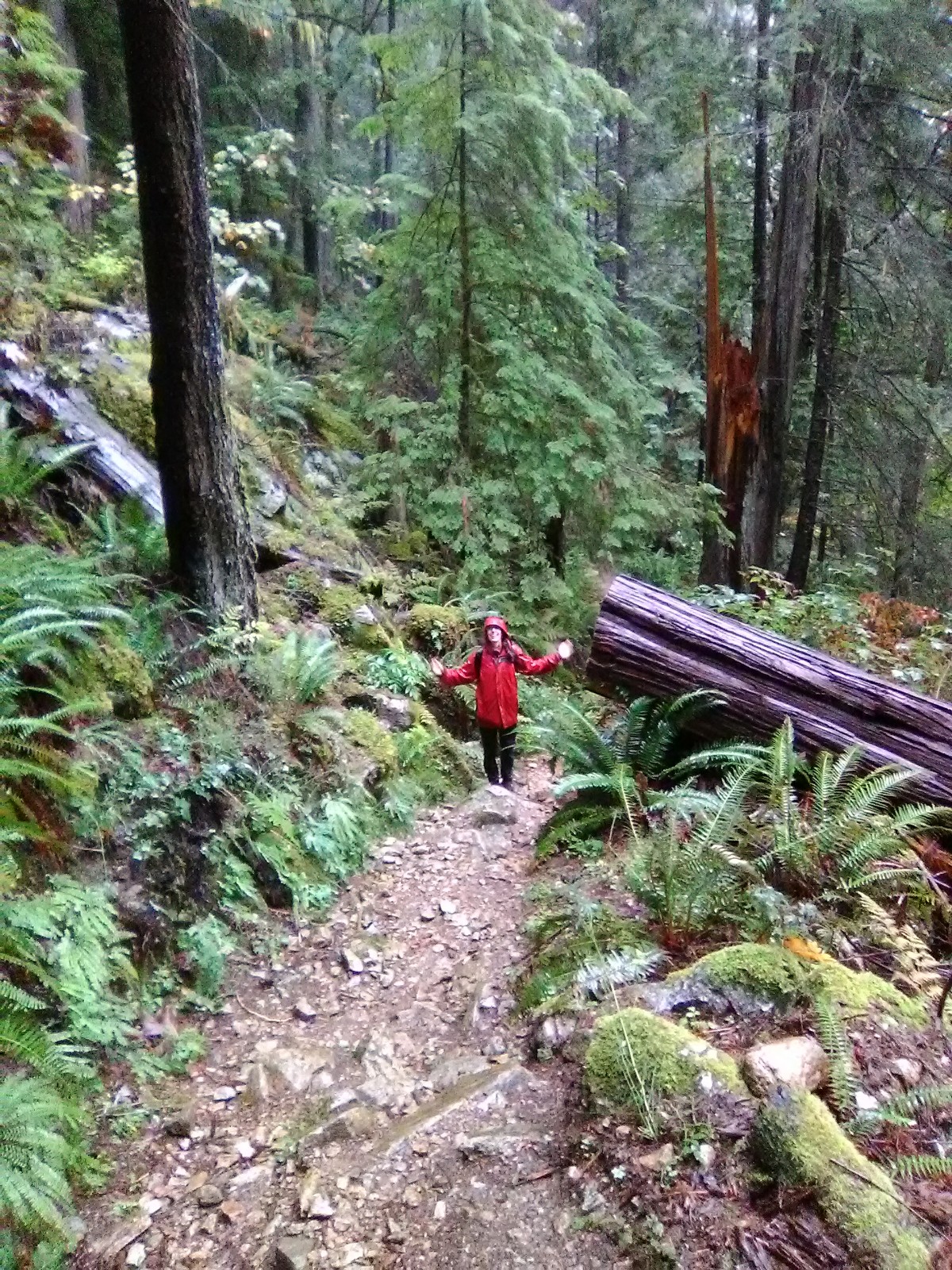
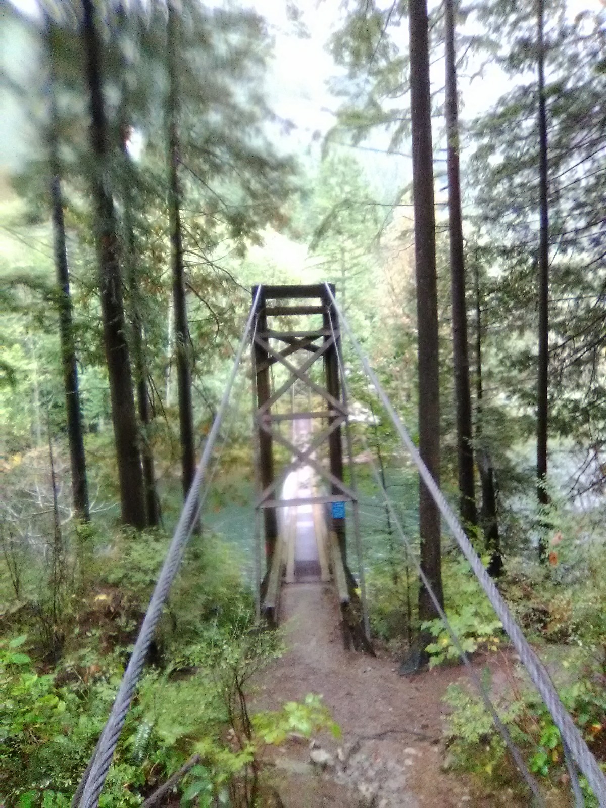
Basic trail description: Hiking time: 3-4 hours. Distance: 11km loop. Elevation gain: 150 m (though I call total bullshit on this because there was *a lot* of up and down. We probably climbed closer to 400m up). Portions of this trail are very steep and slippery. From the South Beach parking lot head left past the boat launch. Cross over the floating bridge at the south-west end of the lake. Head right along the Old Buntzen Lake Trail. Head left on the Lakeview Trail. A mid-level trail along Buntzen Lake’s western shore, this trail weaves its way along Pumphouse road, the Old Buntzen Lake Trail and dips into the west-side transmission line before slipping into the dense forest that enfolds Buntzen Ridge. At the north end of the lake cross the suspension bridge and join the Old Buntzen Lake Trail near North Beach. You will return to South Beach on the regular Buntzen Lake Trail.
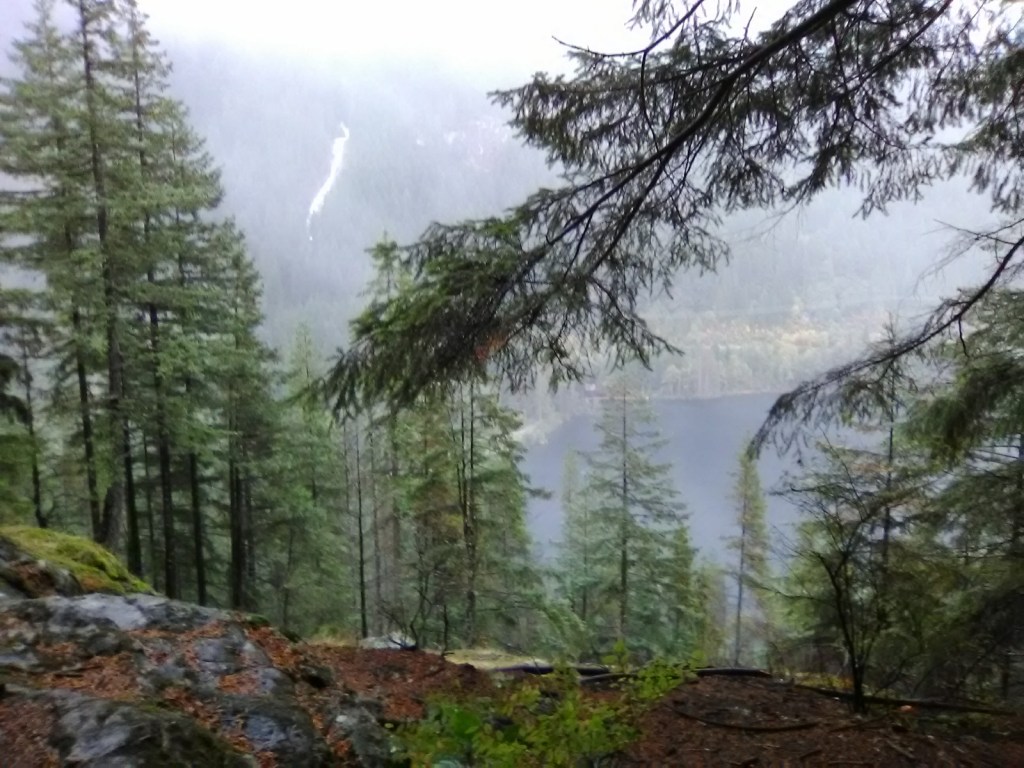
Notes: This is an *on-leash* dog trail. No one had their dogs on leash and it’s was super annoying. There are new outhouses at the north end and flush toilets on the south end. We went when there was a detour on the West Side and the signs were super confusing. We walked down partial trails a few times which added to our time out there. Much of the trail is exposed so we were soaked in the rain. The viewpoints are all so beautiful, enjoy them. There were also portions of this trails that were mind-blowing. We saw numerous banana slugs and fresh moss growing sideways from trees. Bears frequent the area, bring a noisemaker and some bear spray just in case!
Also: My good friend, Amanda, came on this hike with me. She’s got an inspiring tree project called Tracking Giants [LINK] where she’s visiting all 43 trees on the BC Big Trees Registry. Check her out.
